A demonstration forecast of South Platte River flows 15 years in advance
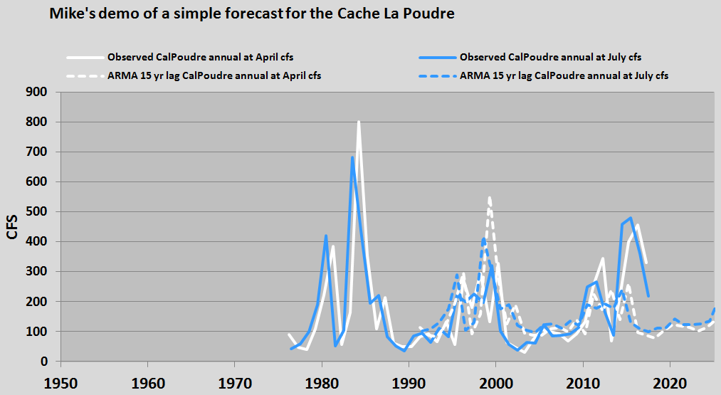
The South Platte catchments of Central and Northern Colorado along with surrounding environs comprise an interesting climate zone of North America. They are close to what I interpret as a quasi-stationary inflection in the hydrosphere. Those conditions present potential opportunities for high fidelity and often routine ARMA* forecasting results. In the featured image, the observed (solid lines) and the ARMA based forecast (dotted lines) annual averages of the flows past a Cache la Poudre tributary gage of the South Platte River in Colorado for Spring and Summer are shown.
The best autocorrelations are for approximately a 15 year lag. From that information the resulting forecasts shown are for 15 years in advance. I eliminated two outliers in developing the regressions. By some standards, such as anticipation of general descents into drought and emergence from drought, these conventional white and blue ARMA exercises appear to indicate a fair fit of a future forecast to a past history of the same stream to date.
This introductory post draws in part from Auto Correlation Functions (ACFs) for streams and the Sun.
*Auto Regression Moving Average
 4037total visits,1visits today

