by admin_37678 | Mar 9, 2025 | Uncategorized
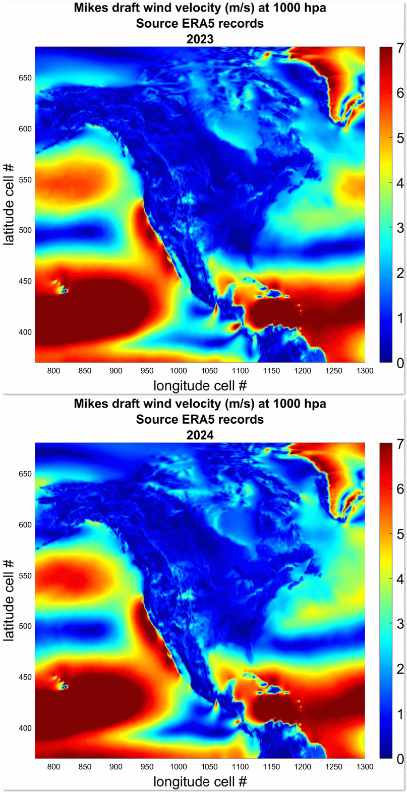
MWA has projected North American winds one year in advance, better, apparently, than any current AI or DOE Exascale climate simulator. This map serves as a departure point. Customers can contact us via email with a latitude and longitude coordinate for the area that...
by admin_37678 | Jun 28, 2023 | Uncategorized
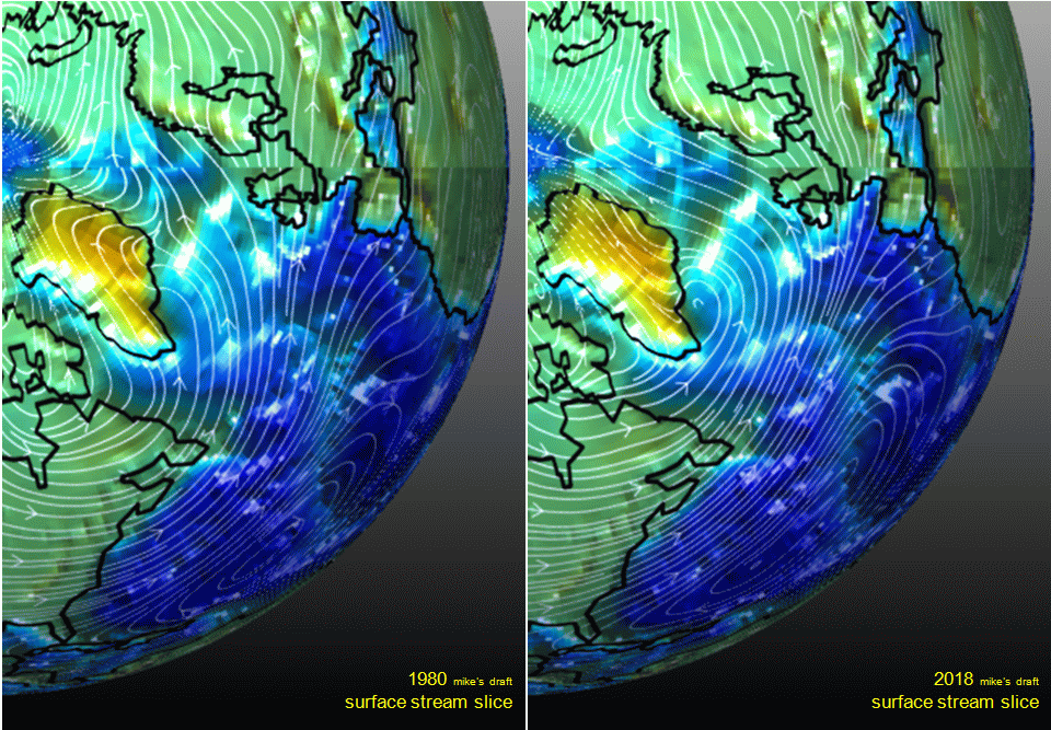
closing in on merid transport and related solar driving notion update 1 October 2024, Mopping up after a blast at scientific sounder meeting in Pasadena, CA. To attend to more closely, please consider following @Mike8Wallace. In either case, you’ll get what you...
by admin_37678 | Jun 17, 2023 | Uncategorized
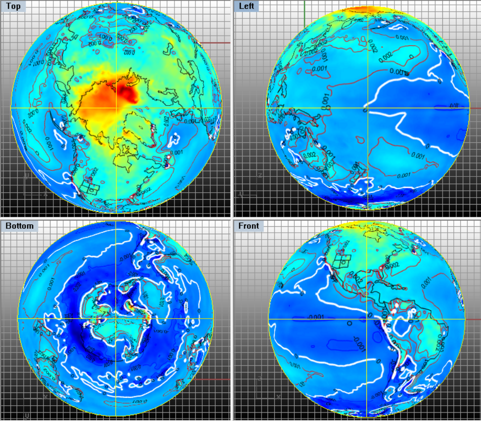
I’ll integrate all temperature content in a submission for peer review. The featured image at top is simply a set of views of the trend of temperature over this time period near the surface. The white contour line is the zero trend. Blue is cooling and reds are...

by admin_37678 | Apr 18, 2023 | Uncategorized
I’ve been developing analyses but also reading past research. I plan to cite in the development of a set of manuscripts with others. I’m posting the draft reference list. The citations along with related exercises together may also continue to support my...
by admin_37678 | Oct 15, 2022 | Uncategorized
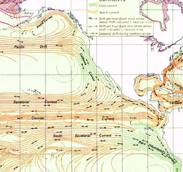
The upwelling of Dissolved Carbon Dioxide (DCD) from cold ocean currents such as the Peru (Humboldt) Current has long been as evident as the featured image cropped from a US Navy ocean current map published in 1946. The quantification of upwelling evidence continues...
by admin_37678 | Aug 28, 2022 | Uncategorized
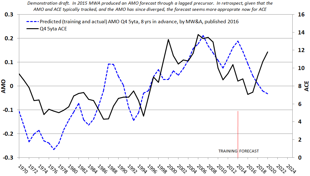
The featured image reflects a partially tested decadal scaled hurricane forecasting product series. We use a proprietary precursor to conduct lagged forecasts of various averages of Accumulated Cyclone Energy (ACE). In a past post, I reviewed this potential product,...
