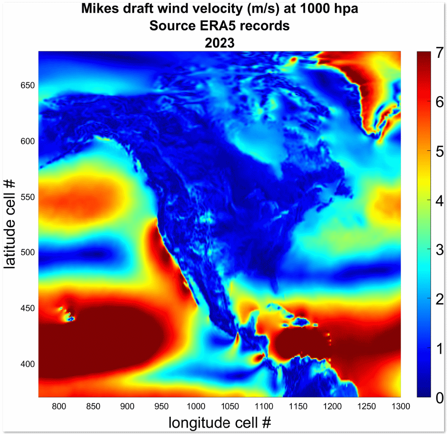
MWA has projected North American winds one year in advance, better, apparently, than any current AI or DOE Exascale climate simulator. This map serves as a departure point. Customers can contact us via email with a latitude and longitude coordinate for the area that they would like us to deploy a wind forecast for one year later.
See contact page for our email address, and include a link to your institution or business listing.
Prices for wind projections are first geared towards Ranchers, Farmers, Traders, and other businesses that rely on wind information for renewable energy and other concerns. Wind projections are not guaranteed but are based on relatively skillful but proprietary hindcast exercises.
Separate streamflow and surface humidity projection services are also available.
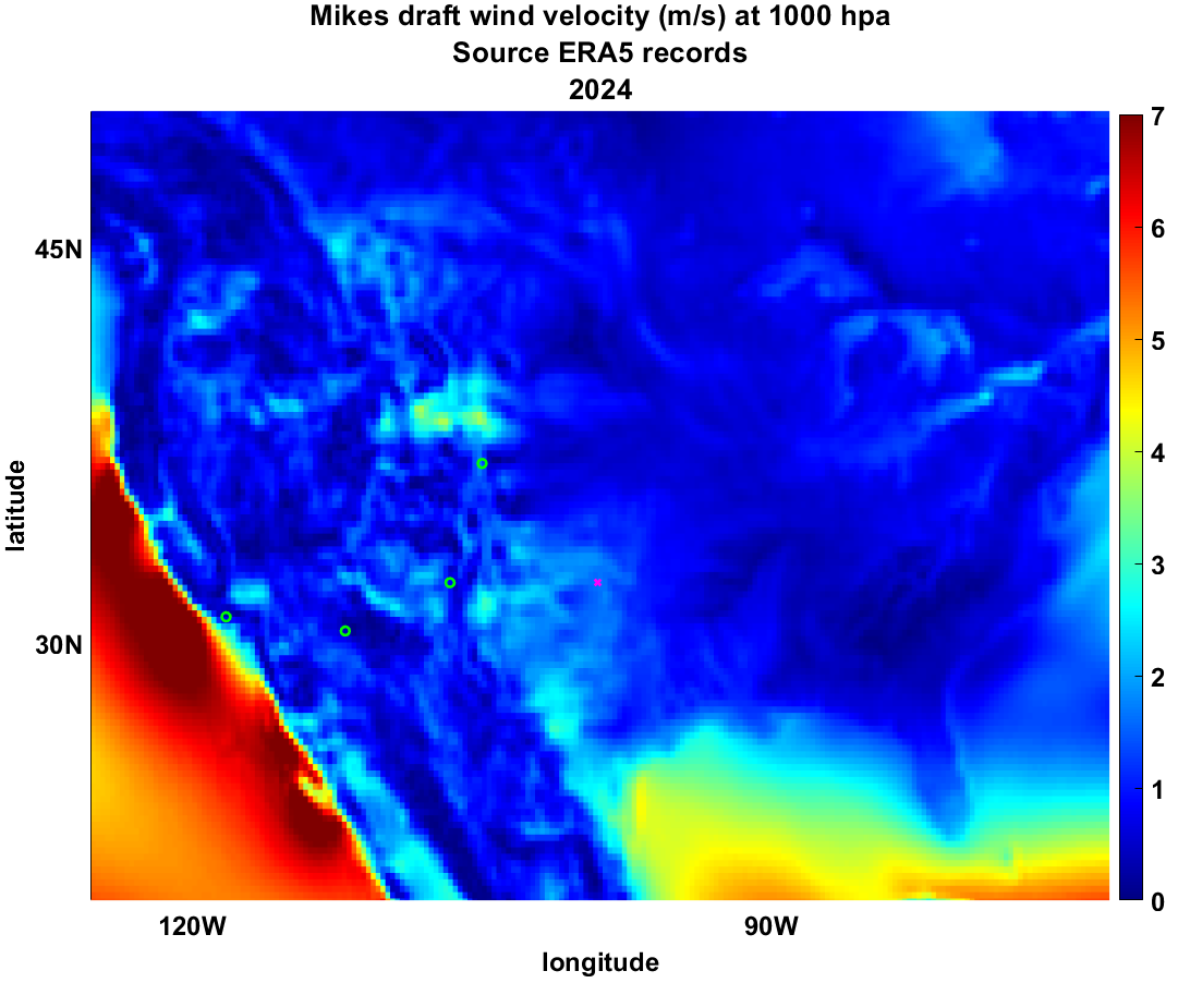
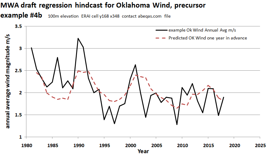
Early example of a hindcast for wind at 100 m based on ERAI resource for the magenta “X” location in the actual “observation” map above. This location is just west of Oklahoma City, OK. In these examples, the observations come from coarse resolution ERA5 data. Actual wind forecasts will be resolved to a specified weather surface station. For additional context, four major metro regions of the US Southwest are shown as open green circles, starting from left to right: Los Angeles, Phoenix, Albuquerque, and Denver.